
West Marin to Sonoma
Trip August 20 – 27
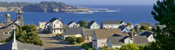
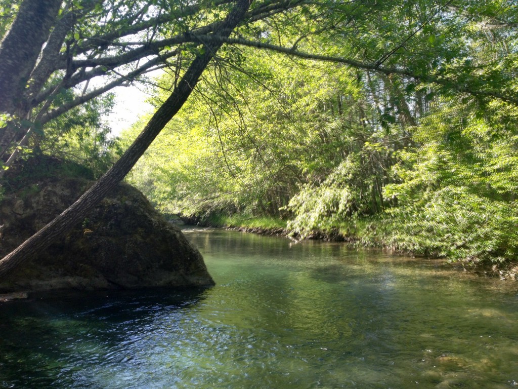
Night One – Olema Campground
 Marin County – Pt. Reyes/Olema
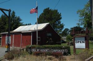
Camping: Olema RV Resort & Campground
Located near the 100,000-acre Point Reyes National Seashore is Olema RV Resort and Campground This park provides 187 total sites on 30 wooded acres, including 50 sites designated for luxury buses. Full hookups with 50/30 amp service is available on 26 sites, and amenities include an RV club room and a playground. Visitors may explore Point Reyes by bike or by horseback, or simply hike their way to the beach.
10155 Highway 1
Olema, CA 94950
Local Phone: 415-663-8106
Email: ed@olemarvresort.com
Restaurants: In Point Reyes Station – Cafe Reyes (moderate prices), Station House Café (a little more $$), Stellinas or the Olema Inn (fine dining) and Farm House in Olema.
Hiking: http://www.nps.gov/pore/planyourvisit/hiking_guide.htm
Beaches: http://www.nps.gov/pore/planyourvisit/beaches.htm
Night Two – August 21
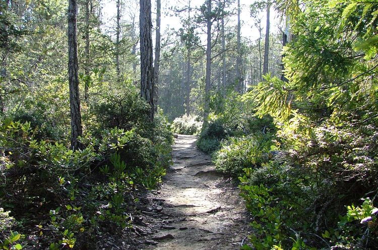 Van Damme State Park
Mendocino County
Van Damme State Park consists of beach and upland on the Mendocino Coast. Of all the park system’s units along the Mendocino coast, Van Damme is perhaps the richest in terms of historical resources connected with the redwood lumber industry. Its story is a prime example of the struggles and eventual failures of a small, independent lumber operation.
Location/Directions: The park is located three miles south of the town of Mendocino on Highway 1. The highway runs through the park separating the campground and the Fern Canyon trail head to the east and the beach and parking lot to the west. http://www.parks.ca.gov/?page_id=433
Hiking Trails
Fern Canyon – https://www.parks.ca.gov/?page_id=28433
 Restaurants – http://www.mendocino.com/restaurants_all.html
Organic Store – Harvest Market – http://www.harvestmarket.com/
171 Boatyard Drive
Fort Bragg
707-964-7000
10501 Lansing Street
Mendocino
707-937-5879
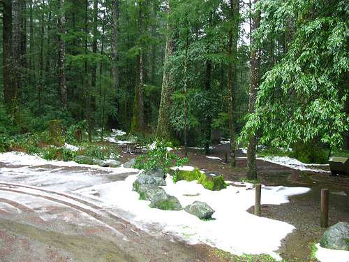
Nights Three / Four– August 22-23 – Albee Creek Campground
 Humboldt County
Humboldt Redwoods State Park – Weott CA 95571 707-946-2409
Albee Creek in the Humboldt Redwoods State Park.
Avenue of the Giants: http://avenueofthegiants.net/
Night Five / Six – August 24-25 – King Range
You may want to get provisions before you go to Mattole in Honeydew 44670 Mattole Road Honeydew, CA 95545, (707) 629-3310.
King Range National Conservation Area – Campgrounds
These are FIRST COME FIRST SERVE sites
Six CAMPGROUNDS options- FEE AREAS – all sites $8.00:
Off U.S. Highway 101 at Garberville or Redway, west 16.5 miles on Briceland/Shelter Cove Road. 68,000-acre area. Open all year, no reservations. Facilities are kept to a minimum in order to preserve the area’s rustic and semi-primitive qualities.
Mattole Campground
Location: North end of King Range at the beach. U.S. 101 at Garberville, South Fork/Honeydew, or Ferndale exits. Follow signs toward Petrolia, turn on Lighthouse Road to ocean.
Facilities: 14 tent/trailer campsites with picnic tables, fire rings, vault toilets, no hookups. Potable water. Lost Coast Trailhead and parking area. Wheelchair accessible. No OHV access.
 Honeydew Creek Campground
Location: U.S. 101 at South/Fork Honeydew exit. Follow signs to Honeydew, turn south onto Wilder Ridge Roadtoward Ettersburg for 1 mile.
Facilities: 5 tent/trailer campsites with picnic tables, fire rings, vault toilets. No water (campground is near creek; treat water before drinking), no hookups. Wheelchair accessible.
Horse Mountain Campground
Location: U.S. 101 to Redway, west 22 miles on Briceland/Shelter Cove Road, then 6.5 miles north on King Peak Road.
Facilities: 9 tent/trailer campsites with picnic tables, fire rings, pit toilets. No water. No hookups.
Tolkan Campground
Location: U.S. 101 to Redway, west 22 miles on Briceland/Shelter Cove Road, then 3.5 miles north on King Peak Road.
Facilities: 5 trailer/4 tent campsites with picnic tables, fire rings, vault toilets. No hookups. Potable water. Wheelchair accessible. This campground provides easy access to the Paradise Royale Mountain Bike Trail.
 Nadelos Campground
Location: U.S. 101 to Redway, west 22 miles on Briceland/Shelter Cove Road, south 1.5 miles on Chemise Mountain Road.
Facilities: 8 tent campsites with picnic tables, fire rings, vault toilets. No hookups. Wheelchair accessible. Chemise Mtn. Trailhead. Entire campground may be reserved for overnight group use for $85 per night. Minimum number of people in group is 20, and maximum group number is 60. All applications and fees must be received 30 days prior to the first use day. To request a permit application please call the BLM King Range Project Office at 707-986-5400. NO group reservations are available Memorial Day weekend, Fourth of July weekend or Labor Day weekend.
Wailaki Campground
Location: U.S. 101 to Redway, west 22 miles on Briceland/Shelter Cove Road, south 2 miles on Chemise Mountain Road.
Facilities: 13 tent/trailer campsites with picnic tables, fire rings, vault toilets. No hookups. Wheelchair accessible.Chemise Mtn. Trailhead.
Night Seven – August 26 – Salt Point State Park
Sonoma County
20 miles North of Jenner on Hwy One Salt Point State Park includes six miles of the Sonoma Coast, ranging from sandy beach coves to steep bluffs and sandstone cliffs. At the top of the coastal ridge there is a large prairie and pygmy forest. Wildlife includes the long-tailed weasel, wild pigs, brown pelicans and other water birds, blacktail deer, raccoons, coyotes, and a variety of rodents. The park has miles of hiking and horseback trails. The area is also the site of an underwater reserve for divers.